

Throughout his career at NS, Chris has supported a variety of engineering and field initiatives, including Positive Train Control (PTC) validation, mobile LiDAR mapping and surveying projects spanning the railroad. Today, much of his work focuses on using drone technology to capture highly detailed information that helps teams make informed decisions and complete projects more efficiently.
Profile: Meet one of the NS engineers behind LiDAR mapping projects
Oct 09, 2026
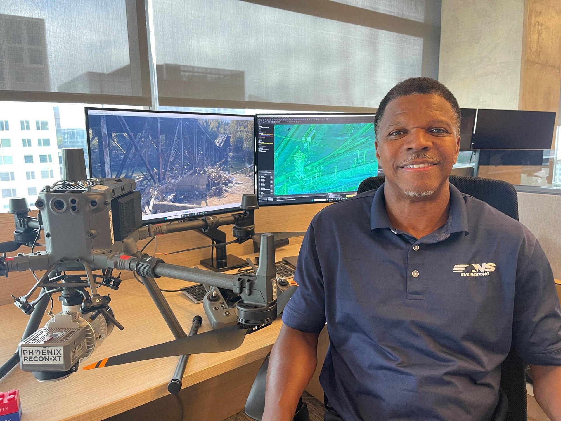
For more than 14 years, Christopher Craddock has been part of the team that has been the driving forces behind Norfolk Southern’s efforts to modernize engineering workflows through surveying, mobile LiDAR, and aerial data collection technologies. As a licensed land surveyor and Senior Field Validation Engineer, he is part of the Data Acquisition & Mapping department’s Unmanned Aircraft Systems (UAS) LiDAR, and photogrammetry program, helping transform how engineering teams see, measure, and understand the railroad.
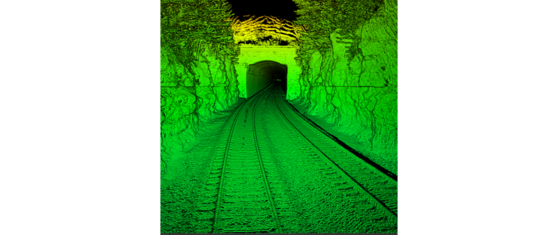
What is LiDar?
LiDAR (Light Detection and Ranging) is a remote sensing technology that uses laser pulses to create highly detailed, three-dimensional representations of the surrounding environment. At NS, the technology helps engineering teams safely capture accurate data used for mapping, planning, asset management, and other critical railroad operations.
Currently, Christopher’s work centers on using drone platforms equipped with aerial LiDAR sensors to capture highly precise spatial data. These systems produce “point clouds,” which are dense, 3D datasets created by laser pulses that measure millions of points per second. The result is an accurate digital representation of the railroad environment, terrain, vegetation, structures, clearances, and track geometry.
“The drone is one of our data collection platforms. LiDAR lets us capture information with speed, accuracy and, most importantly, with a safety-first mindset.” — Christopher Craddock, NS Senior Field Validation Engineer.
While much of Christopher' work involves collecting data, he emphasizes that the process doesn't end there. The information gathered through LiDAR becomes valuable when it is analyzed and applied by NS employees across engineering, operations, and technology teams. Together, those teams use the data to support infrastructure planning, clearance analysis, asset management, digital twin development, and other critical railroad functions.
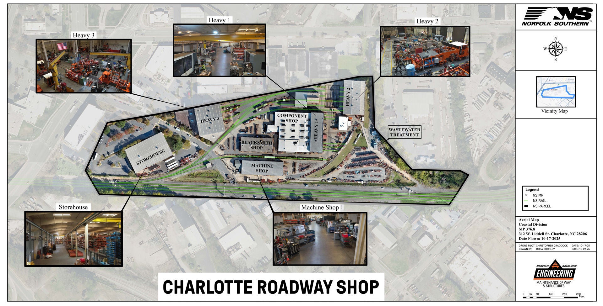 As part of the Charlotte Roadway Shop mapping project, drone technology captured both the aerial imagery used to create this map and the detailed interior building views shown in the inset photos, helping provide a more complete picture of the facility.
One of his most memorable recent projects involved capturing interior imagery of the Charlotte Roadway Shop, a rare and challenging indoor drone mission. Without GPS, with magnetic interference, and in tight spaces, indoor flying requires constant manual control and precision. The operation was completed incident-free, showcasing his technical expertise and situational awareness.
With over 20 years of experience working with LiDAR data, Christopher has seen the technology evolve from a specialized tool into one of the most accurate and widely adopted systems in modern engineering.
Elevating safety, efficiency, and decision-making
Traditional surveying often required employees to work close to active tracks or in difficult rail yard environments. LiDAR dramatically reduces exposure.
By collecting data remotely and providing engineering teams with highly detailed information, LiDAR helps employees work more efficiently while supporting informed decision-making in the field.
LiDAR also enhances operational efficiency across departments:
Key applications of LiDAR & aerial data
- Vegetation analysis & proactive maintenance:
Quantitative vegetation measurements help prevent encroachment issues before they become safety risks. - Track safety monitoring & PTC support:
High-resolution datasets ensure accurate information for NSGIS database and other safety systems. This data is fed into Digital Twins. - Engineering project planning:
LiDAR provides detailed topography and 3D context for design, grading, and construction planning. - Wire & leasing agreement support:
Precise models assist in verifying clearances and existing infrastructure for agreements. - First response to derailments:
Archived point cloud data and rapid field capture enable accurate staking, alignment checks, and swift recovery to help restore rail service. - Asset management & digital twin integration:
LiDAR data by-product feeds into the company’s digital system, improving infrastructure modeling, and long-term maintenance planning. - Volumetric and structural analysis:
From earthworks to structural clearances, LiDAR gives engineering teams better tools for measurement and validation. - 360° imagery and high-definition aerial mapping:
Advanced imagery supports visualization, inspection, and planning across disciplines.
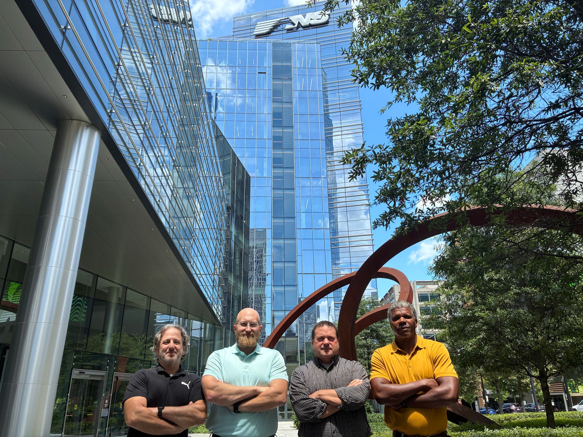 Behind Norfolk Southern's LiDAR program, the Data Acquisition & Mapping team supports safer, more informed decision-making across the network. Pictured left to right: Michael Allen, Ryan Lawson, James McIntyre, and Christopher Craddock.
Leadership in UAS Operations
Christopher oversees the drone field acquisition platform for his team, ensuring safe operation, rigorous compliance, and ongoing staff education.
This includes:
- FAA airspace checks
- Mission risk analysis
- Airspace authorizations in restricted zones
- Flight path planning
- Ground control point setup
- Coordination with engineering teams
- Maintaining situational awareness of evolving drone regulations
He collaborates closely with other departments and subject matter experts across NS, ensuring the raw data collection moves to an actionable by-product for decision making, planning, and other various uses for business partners within the company.
The technology behind the work
Christopher's work is just one example of how NS employees are using LiDAR technology to help teams make more informed decisions across the railroad. From engineering design and infrastructure planning to vegetation management, severe weather response, and derailment recovery, LiDAR is helping transform data into insights that support safer, smarter operations across the network.
Learn more about the technology
Want to see how LiDAR is helping employees across Norfolk Southern work safely and efficiently?
Read:
How LiDAR technology is helping Norfolk Southern see the railroad differently
By Kasandra Jenkins, Communications Manager
Kasandra Jenkins assists with external communications for Norfolk Southern as a Communications Manager, focusing on community impact, awards, and media relations. Kasandra joined NS in 2025, with more than 10 years of media relations, and corporate/crisis communications experience.
CONTINUE READING
How NS is shaping the next generation of Women in Technology
Oct 09, 2026
NS and WIT give students a look inside tech careers Top Takeaway: Through our partnership with Women in Technology, Norfolk Southern is helping inspire the next generatio...
Profile: Meet one of the NS engineers behind LiDAR mapping projects
Oct 09, 2026
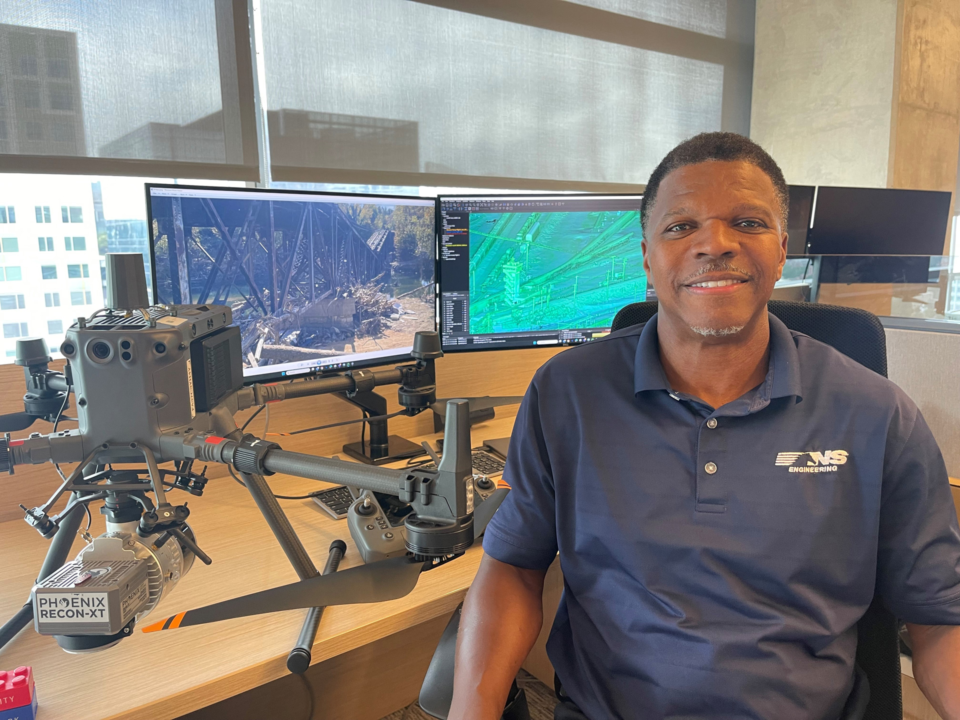
For more than 14 years, Christopher Craddock has been part of the team that has been the driving forces behind Norfolk Southern’s efforts to modernize engineering workflo...
Norfolk Southern celebrates completion of Living Shoreline restoration
Oct 07, 2026
Norfolk Southern marked the completion of its Living Shoreline restoration at Lamberts Point on Oct. 6, bringing together community and environmental leaders as well as N...
Media Contacts
Are you a member of the media? Contact our media relations team.

